Camera tour
Price: Free
Phone: 0988 486 112
Time to visit a place: 120 phút
Open Time: 7:00 AM - Close Time: 6:00 PM
Email: dlstnahang@gmail.com
Address: Long ho thuy dien Na Hang commune, Tuyen Quang Province
Pac Ta Mountain is the highest mountain in Na Hang district - Tuyen Quang. The mountain has the shape of an elephant standing next to a bottle of wine. Standing tall, majestic, hiding and appearing in the clouds beside Tuyen Quang hydropower reservoir, Pac Ta mountain is an inspiration for writers, artists, tourists to compose poetry, painting and photography. At the foot of Pac Ta mountain, there are traces of an ancient temple. Pac Ta Temple is a place of worship and memory of the fiancee of General Tran Nhat Duat.
Pac Ta temple ruins are one of the remaining vestiges proving the second resistance war against the Nguyen - Mong in 1285: the talented general Chieu Van Vuong Tran Nhat Duat at that time was defending the wise land of Tuyen Quang. skillfully led the army against the enemy from Yunnan. According to historical documents, Pac Ta temple was built in Gam Giang under Ta Son mountain to worship and admire the fiancé (fiancee) of Chieu Van Vuong Tran Nhat Duat.
The image of the fiance of Chieu Van Vuong Tran Nhat Duat has been put on by the people here in a thrilling legend handed down from generation to generation. Legend has it that: During the time of defending the ancient Tuyen Quang land, Chieu Van Vuong Tran Nhat Duat fell in love with the daughter of a local chief. The young girl in the mountainous region is talented, beautiful, with a gentle disposition, and comes from a studious family. After expelling the Nguyen - Mong invaders, the court organized a wedding ceremony for General Tran Nhat Duat with his daughter from Tuyen. On the way to pick up General Tran's fiancee back to the capital, there was a fierce tornado causing the boat to capsize. Tran Nhat Duat's young wife and her entourage sank in the river. Several days have passed, and her body has not been found. Feeling sorry for her situation, the Court ordered the people on both banks of the Gam River to organize a search for her body and reward those who found it. At that time, someone from the Ma family recovered her body. To commemorate the young wife of Chieu Van Vuong Tran Nhat Duat, the local people built a temple right where she entrusted.
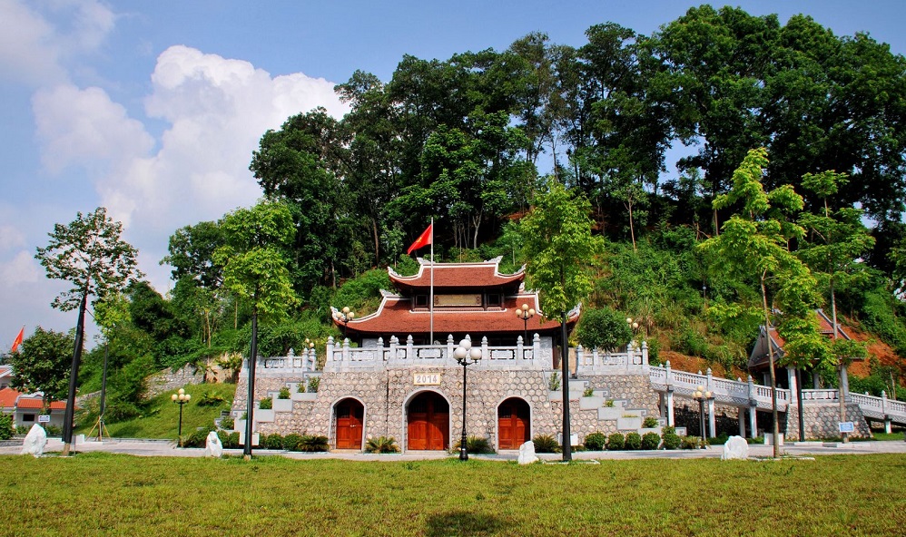
Pac Ta Temple is located on a high, flat terrain at the foot of Pac Ta mountain. The temple door faces south overlooking the Gam river. Initially, Pac Ta temple was located on a promontory on the right bank of Nang river, opposite to the current location. The temple is built with a structure of 3 compartments and 2 wings made of pictures, bamboo, cork and leaves. But one day, there was a big storm, the roof of the temple was swept by the wind across the river to the opposite high land, at the foot of Pac Ta mountain today. Local people believe that this is the will of the Holy Mother, so since then, the temple was built under Pac Ta mountain. Today, Pac Ta mountain and Pac Ta temple are ecological and spiritual tourist attractions attracting domestic and international tourists when coming to Na Hang.
The combination of natural scenery with the rhythm of human life in the highlands creates a charming landscape. This is a sacred temple, people from all over the world come here to trade in rare and precious forest products and stop their boats to burn incense to pray. Today, together with Pac Ta mountain, Pac Ta temple is an ecological and spiritual tourist destination attracting domestic and international tourists.


Distance: 830m
Distance: 2.27km
Distance: 2.30km
Distance: 3.63km
Distance: 5.97km
Distance: 6.84km
Distance: 13.83km
Distance: 13.94km
Distance: 14.48km
Distance: 2.28km
Distance: 2.30km
Distance: 2.61km
Distance: 2.83km
Distance: 3.52km
Distance: 3.61km
Distance: 0m
Distance: 80m
Distance: 210m
Distance: 440m
Distance: 2.17km
Distance: 2.91km
Distance: 8.19km
Distance: 11.75km
Distance: 16.42km
Distance: 17.08km
Distance: 18.38km
Distance: 18.89km
Distance: 19.19km
Distance: 19.22km
Distance: 19.33km
Distance: 19.34km
Distance: 20m
Distance: 1.36km
Distance: 1.36km
Distance: 1.36km
Distance: 1.36km
Distance: 1.36km
Distance: 1.36km
Distance: 1.36km
Distance: 1.36km
Distance: 1.36km
Distance: 1.36km
Distance: 1.36km
Distance: 1.36km
Distance: 1.36km
Distance: 1.36km
Distance: 1.36km
Distance: 1.36km
Distance: 1.37km


